Choosing and checking control points for coordinate transformations
Use correctly identified, well-distributed reference points and independent checks to connect survey coordinate systems without hiding incompatible evidence.
Define the transformation question first
A coordinate transformation connects defined source and target references. Begin by identifying both systems completely, including units, axes, datum realisations, coordinate epochs and height types where relevant. Do not start by fitting nearby points until two maps appear to overlap. A visually useful overlay may not represent the reference relationship required by the project.
Determine whether an authoritative operation already exists and whether it is suitable for the area and intended use. A locally fitted relationship may be appropriate in some project workflows, but it should have a clear purpose and approval. The method must follow the reference definitions and evidence rather than being chosen solely because it gives the smallest residual on a convenient point set.
Continue learning Local site calibration: connecting GNSS to project coordinates
Confirm point identity before using coordinates
Every common point must represent the same physical mark in both reference datasets. Review descriptions, photographs and mark status. Similar names or nearby locations are not sufficient. A point may have been rebuilt, disturbed or assigned different identifiers over time. Misidentified control can distort a transformation even when the fitting software reports a mathematically successful result.
Check the provenance and quality of both coordinate sets. A precise new GNSS observation and an approximate legacy map position should not be treated as equally reliable without justification. Preserve source records and uncertainty information. The transformation can only be interpreted properly when the evidence behind its defining points is understood.
Continue learning Handing GNSS survey coordinates to CAD teams without losing meaning
Distribute control for the intended geometry
Choose points that support the transformation across the project area and relevant elevation range. A cluster near one corner may provide weak evidence about distant areas. The necessary distribution depends on the method and project geometry. Avoid a universal rule based only on point count; the spatial arrangement and quality of points matter.
Consider where the transformation will be used relative to the defining control. Extrapolation beyond the supported area can behave differently from interpolation within it. Document the intended area of use and limitations. If the project expands, reassess the control and method rather than assuming the original fitted relationship remains suitable everywhere.
Continue learning Independent checkpoints for drone mapping: testing the result honestly
Select a method with a defensible purpose
Different operations can represent translation, rotation, scale, datum relationships or more complex local behaviour. Use the method appropriate to the reference question and approved survey process. A higher-order fit can reduce residuals while absorbing noise or local inconsistencies. Smaller fitting differences do not automatically mean the operation is a better description of the physical reference relationship.
Record parameter conventions, units and operation order. Software may use different rotation signs or coordinate order assumptions. Preserve the exact implementation or configuration used, not only a verbal description. Test representative points independently of the fitting interface so the adopted relationship can be reproduced in field and office systems.
Continue learning Designing a GNSS ground control point layout for drone mapping
Keep horizontal and vertical relationships clear
A horizontal transformation does not automatically establish a compatible height reference. State how elevations are handled and whether a separate geoid, vertical grid or local adjustment is required. Do not fit an unexplained elevation offset simply because the horizontal points agree. Investigate source height types, antenna conventions and benchmark evidence first.
Where a combined three-dimensional method is approved, preserve the complete source definitions and required inputs. Coordinate epoch may also matter for some frame relationships. Avoid simplifying the workflow to a two-dimensional operation if the project’s reference requirements need more information. The delivered metadata should explain which components were transformed and which remained unchanged.
Continue learning Local site calibration: connecting GNSS to project coordinates
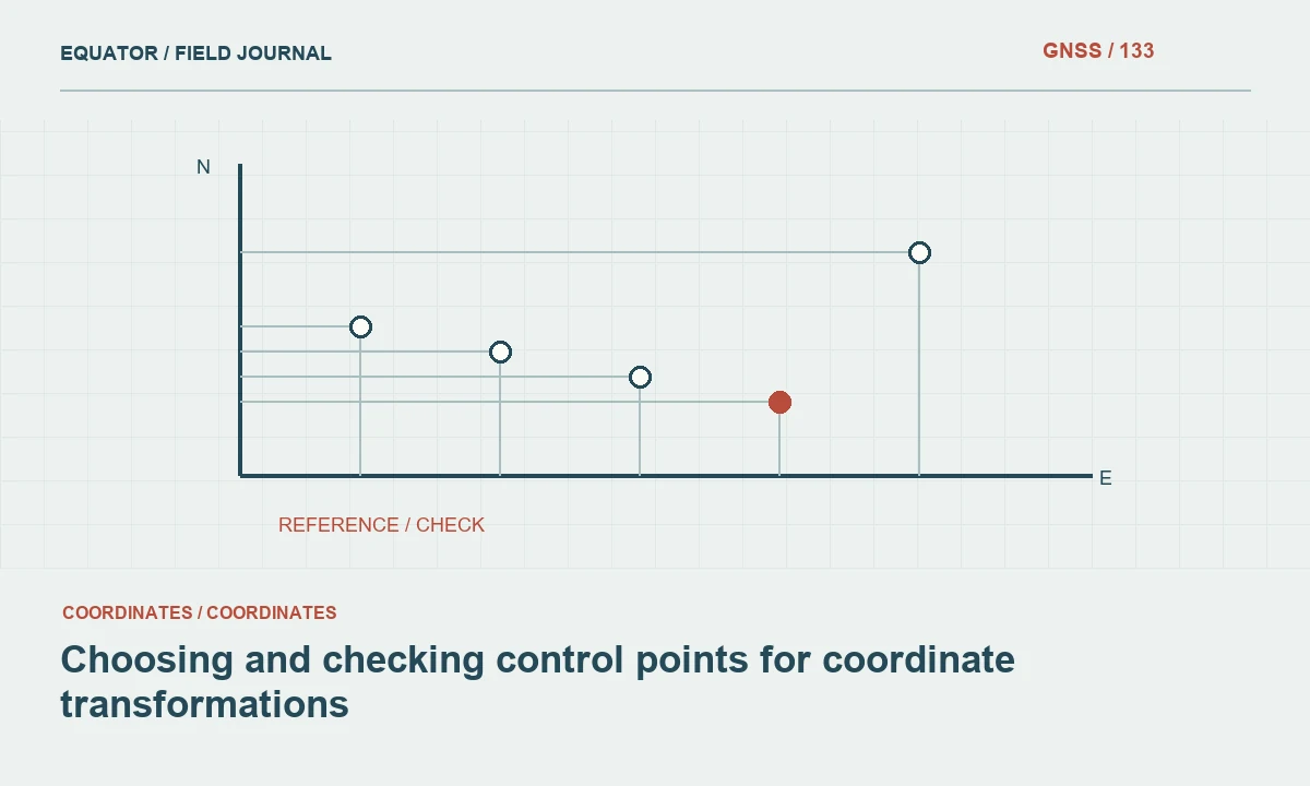
Reserve independent check points
Points used to determine transformation parameters test the fit to the defining evidence. Independent points test how the adopted operation performs outside that fit. Reserve suitable checks before estimation where the project method requires them. Do not describe all residuals as independent if the same points contributed to the parameter solution.
Distribute checks across the intended area and examine their differences spatially. A rotation or scale problem can be small near one point and larger elsewhere. Record the assessment criteria and exclusions. If a check fails, investigate point identity, source quality and operation suitability before adding flexibility to the transformation merely to absorb the discrepancy.
Continue learning Handing GNSS survey coordinates to CAD teams without losing meaning
Investigate outliers without hiding evidence
Review large residuals through the original observations and metadata. Possible causes include a disturbed mark, wrong identifier, unit error, incompatible epoch or a genuine limitation of the chosen relationship. Keep rejected points and document the reason for exclusion. Deleting a point because it worsens the fit is not a sufficient technical explanation.
Compare trial solutions through the approved process, considering independent performance and physical meaning. Preserve the adopted parameters and the evidence behind the decision. A transformation should simplify a defined reference relationship, not conceal disagreement among sources. If the evidence cannot support the required result, report the limitation and identify additional observations or reference information needed.
Continue learning Independent checkpoints for drone mapping: testing the result honestly
Deliver a reproducible transformation package
Provide source and target definitions, control and check schedules, parameter conventions, software version, residual assessment and area of use. Include representative example conversions and their expected outputs. State how heights and epochs are handled. A recipient should be able to implement and verify the operation without guessing which direction a parameter applies.
Preserve original coordinate sets and version any derived outputs. If the operation changes, identify affected datasets and retain the earlier release for historical interpretation. Reliable coordinate transformation is an evidence-based survey operation. Its quality comes from defined references, correct point identity, suitable geometry and independent checks, rather than from the apparent smoothness of an overlay.
Continue learning Designing a GNSS ground control point layout for drone mapping
Test an attractive but overfitted solution
Suppose a flexible local fit produces almost no residual at its defining points but performs poorly at independent checks. Review whether the method is absorbing noise or inconsistent source coordinates. A near-perfect fit to the inputs does not establish that the operation behaves correctly elsewhere. Compare a physically appropriate simpler method and investigate the defining point evidence.
Document the trial results and choose the approved operation based on the full assessment, including intended area and use. If no method meets the requirement, obtain better control or qualify the delivery. Do not remove independent checks merely to preserve an attractive fitting report. Their value is precisely that they can reveal a relationship that looks excellent at its inputs but is unreliable for the project.
Include the failed independent-check evidence in the decision record, even if the adopted solution comes from a different method. It explains why the more flexible trial was rejected and prevents another operator from selecting it later solely because its fitting residuals look attractive. Preserve the point roles and assessment criteria alongside the parameters. A transformation handover is stronger when it records the evidence that constrained the choice, rather than presenting only the final values with no account of how their suitability was tested.
Continue learning Local site calibration: connecting GNSS to project coordinates
Practical checklist
- Verify physical point identity and coordinate provenance first.
- Distribute defining control and reserve independent checks.
- Deliver parameter conventions, limits and example conversions.
Plan your GNSS setup
Compare the EQ10 and EQ20 receiver specifications, then discuss the configuration and support your project needs.
Compare GNSS receivers