Diagnosing interference symptoms in GNSS correction radios
Separate radio delivery problems from satellite observation problems and use controlled comparisons to narrow the cause.
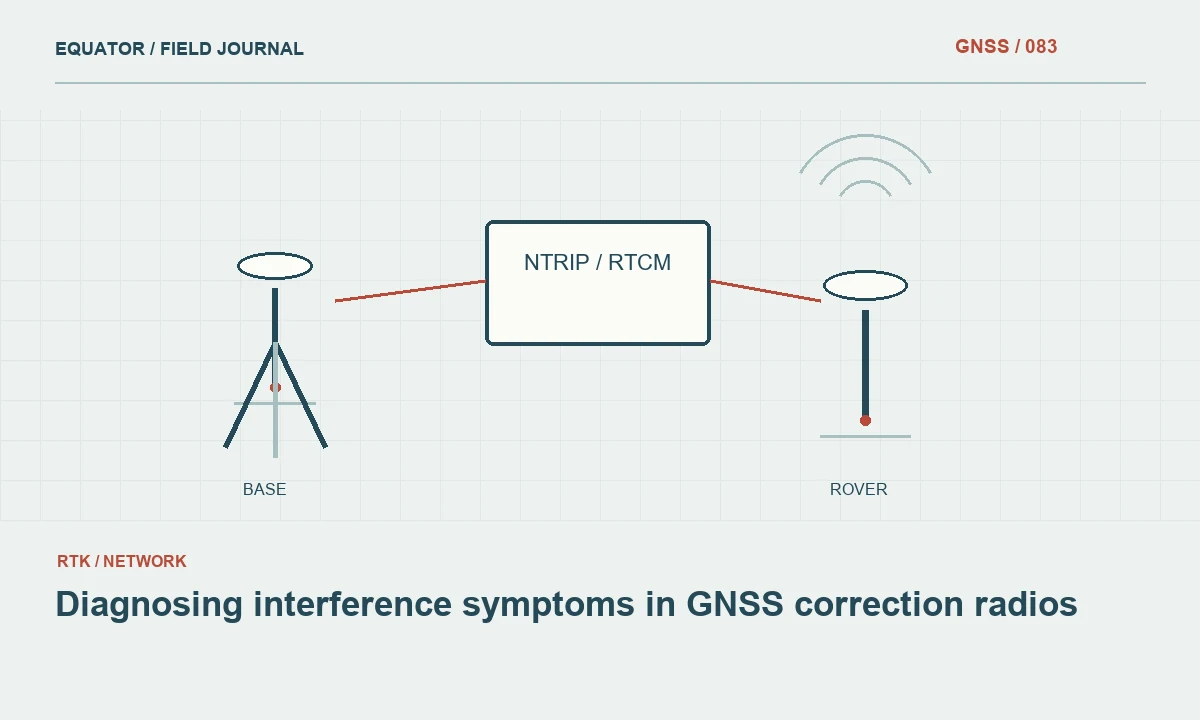
Define the affected system
The word interference can refer to several different problems in a GNSS workflow. A correction radio may fail to deliver data, while the receiver's satellite observations can be affected by a different source or by local reflections. Begin by identifying which evidence changed: radio reception, correction age, satellite tracking, solution state or coordinate checks. Do not assign one cause to every symptom simply because the event occurred near other electronic equipment.
Record the actual equipment path and configuration. A receiver using an internet correction source may not depend on the radio the operator is inspecting. Conversely, a local wireless link between controller and receiver may fail while the long range correction radio remains healthy. A simple system diagram helps the crew investigate the relevant connection and avoids unnecessary changes to components that are not involved in the current workflow.
Continue learning The ionosphere and GNSS: why conditions can change
Capture the pattern before changing settings
Note the time, location, devices affected and whether the problem is continuous or intermittent. Record correction age and available communications diagnostics. Include nearby operational changes that may be relevant, but label them as observations rather than proven causes. A machine starting at the same time as a failure is a useful clue; it is not enough evidence by itself to establish the mechanism.
Compare with other rovers using the same source where possible. If all units fail together, inspect shared components and source delivery. If one unit fails, inspect its power, antenna, connectors and local settings. Preserve failed records and screenshots without exposing credentials. The pattern narrows the investigation and helps equipment support understand the event, but it should not be used to skip basic checks of the physical communications chain.
Continue learning Responding to suspected GNSS interference in the field
Rule out ordinary delivery problems
Check battery state, cables, antenna connections and the approved operating profile. A loose connector or depleted transmitter supply can resemble interference because data arrive intermittently. Inspect the path for terrain or obstacles that changed as the rover moved. A location dependent failure behind a building may be a coverage issue rather than evidence of another transmitter operating on the same channel.
Confirm that the source itself is producing the intended data. A radio can be functioning while an upstream receiver or output configuration has stopped supplying usable corrections. Keep content and transport separate in the diagnosis. If the rover receives bytes but cannot use them, compare message compatibility and reference information rather than treating every failure to obtain a fixed solution as a radio signal problem.
Continue learning Planning radio line of sight for GNSS correction links
Use controlled comparisons
Where the equipment and project permit, compare a known working antenna, cable or receiver with the suspect component while keeping other variables unchanged. Record each substitution and result. This helps isolate a hardware issue without turning the field test into an undocumented series of changes. Avoid moving the base, changing the stream and replacing several components simultaneously if the purpose is to understand which action mattered.
A test at a more open location can help distinguish a local path issue from a fault that follows the equipment. Keep the same approved configuration and document the move. If the problem disappears, investigate the location further rather than claiming that the equipment is universally sound. The successful comparison describes one test condition; it does not prove that all possible intermittent faults or environmental effects have been excluded.
Continue learning Choosing and documenting a GNSS satellite elevation mask

Change radio settings only through the approved process
Use the manufacturer guidance and the applicable operating arrangements for the site and equipment. Do not randomly increase output power or select unfamiliar channels as a general troubleshooting method. A setting change may introduce compatibility or authorization problems and can make the original failure harder to reconstruct. Record the previous and new values whenever an approved change is made.
If the project has a communications specialist or service operator, provide a concise event record and follow the agreed diagnostic route. Useful information includes equipment models, firmware, antenna arrangement, timestamps and the observed delivery pattern. Keep private account details out of broadly shared reports. Specific evidence is more actionable than an unsupported claim that the area contains interference and the receiver needs a stronger radio.
Continue learning The ionosphere and GNSS: why conditions can change
Consider an approved alternative path
An internet correction link can provide a useful comparison where it is already approved and available. If the same source and coordinate arrangement can be preserved, the test may help separate positioning behaviour from the radio path. Document any reference differences, because switching to another service can change more than communications. A successful alternative connection is not automatically comparable unless its coordinate meaning is understood.
If no reliable delivery path is available, use the project fallback plan rather than continuing critical real time collection under uncertain corrections. Raw logging or another measurement method may be appropriate when validated in advance. Keep provisional observations separate from accepted coordinates. The aim is to contain the consequence of the communications problem while retaining evidence for later diagnosis and avoiding an undocumented change in the survey reference.
Continue learning Responding to suspected GNSS interference in the field
Verify restored operation
After the approved correction path is reliable, inspect correction age and the required solution state. Occupy suitable check points and preserve the results. Record the recovery time and any configuration changes. The successful check demonstrates the measurement outcome after recovery, while the communications diagnostics describe the delivery path. Both are useful, and neither should be presented as replacing the other.
Review observations collected during the suspect interval according to the project criteria. A later stable link does not retroactively validate earlier points. Use event times, quality records and independent checks to define what requires remeasurement or further processing. Preserve the original data and acceptance decisions so the final dataset does not silently conceal a period of uncertain correction delivery behind an otherwise clean export.
Continue learning Planning radio line of sight for GNSS correction links
Turn incidents into a better plan
Summarize recurring events by location, equipment and operating arrangement. Look for patterns supported by several observations rather than one memorable failure. The response may be maintenance, a different approved communications setup or a revised work zone plan. Keep unresolved causes labelled as unresolved. An honest diagnosis boundary is more useful than a confident explanation that cannot be reproduced or supported.
For example, a cable substitution that repeatedly restores delivery under otherwise unchanged conditions points toward a different corrective action than failures shared by every rover at one location. The incident record makes that distinction visible. Effective interference diagnosis is controlled troubleshooting: define the symptom, preserve evidence, rule out ordinary faults, compare configurations and verify recovery. It avoids replacing one uncertain field condition with an equally uncertain explanation.
Preserve a record when no cause is confirmed. Include the tests performed and their limits so the next investigation does not repeat the same substitutions without learning from them. An unresolved incident with useful evidence is preferable to a confidently labelled interference event whose supporting observations cannot distinguish it from a cable or source failure.
Continue learning Choosing and documenting a GNSS satellite elevation mask
Practical checklist
- Identify whether correction delivery or satellite observations are affected.
- Preserve event patterns and change one variable at a time.
- Use approved radio settings and verify coordinates after recovery.
Plan your GNSS setup
Compare the EQ10 and EQ20 receiver specifications, then discuss the configuration and support your project needs.
Compare GNSS receivers